Here is a short travel diary (log) of my travel to Upper Mustang in Nepal in 2010, which borders Tibet. I hope it inspires more Nepalis (and foreigners) to travel inside Nepal. Do leave your questions and comments below.
Enjoy, 🙂
Day 1 and 2: Kathmandu to Pokhara.
There are no regular flight to Jomsom from Kathmandu directly. It has to be via Pokhara only. And It is almost impossible to fly to Jomsom after noon (because strong 100 kilometer winds make it impossible to land on a narrow airstrip perched between two 8000 meters ( 24000 feet) mountains. So we took a quick half an hour flight to Pokhara first. Pokhara is a beautiful valley full of lakes and beautiful high mountains to its north. To any other travelers it would be a nice destination to travel in itself. But as we were itching to start our trek to the former “Forbidden Kingdom of Mustang”, even this beautiful city didn’t sound so appealing now. We wanted to be transported into a different era, away from any civilization we were part of.
The flights to Jomsom from Pokhara (only flies from this place) are very erratic and often canceled because of the monsoon weather. The last flight usually goes around noon. After that the wind in Jomsom makes it almost impossible to land a plane there. Our flight got canceled the first day, as the planes going to Jomsom couldn’t land there because of bad weather there. Be ready to wait for hours at the airport praying for the weather to be good again.
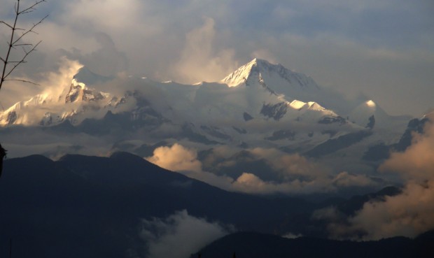
8000+ meters high Annapurna range as seen from Pokhara beyond which is Mustang.
Day 3: Pokhara to Jomsom (2700m) to Kagbeni (2900m)
The next morning by sheer luck, after yet another agonizing 5 hours wait at the airport, we managed to find a flight at 12 30 in the afternoon (this is quite rare during anytime of the year to be flying so late to Jomsom). We later came to know that the flights for the next 2 days got canceled as well.
It was a one hell of a hair-raising half an hour flight, specially the landing part, where the plane had to make a sharp turn by a cliff to come down to the airport. The plane full of hindu devotees were busy chanting “ Hail the Lord pashupati nath” inside the plane as we moved to Jomsom. I must say, Jomsom and Lukla are the two most heart skipping places to land during any time of the year. We flew to Jomsom on a donnair aircraft, Agni Air (German-made). We soon found ourselves in the sunny Jomsom, the administrative capital of Mustang.
Mustang lies in the rain shadow of Annapurna Mountains. It rarely rains much during monsoon as all the rain bearing clouds get stopped by a wall of high rising Annapurna and Dhaulagiri mountains. Still the wind was howling enough to bring out the wind stopper jacket from my back pack. We went to a local friend’s hotel right outside the airport, called, “Hotel Snow Land” and from him got some useful guide to trekking up upper mustang.
At 2 in the afternoon, we started our trek to get to a holy place called Kagbeni via “Eklai bhatti”. Kagbeni is the entrance to Upper Mustang, and a well off modern village right besides the Kali Gandaki river. t is also hugely important place for Hindu devotees who come in droves to offer prayers for their departed parents souls along the holy fusion of the Kali Gandaki river and another flowing from Muktinath (another Hindu holy place in Mustang).
In Kagbeni (2900m),We stayed in New Annapurna Lodge. (By the way, all ,motels and tea-houses in mustang are named hotels). Kagbeni even has a restaurant, aptly called “Yak donalds” and the local fries there are delicious!
In Kagbeni, we met a french group heading up to Upper mustang there, and exchanged a bit of insight with the Nepali guides who were quite amused to hear Nepalis traveling. (Who would have thought ! ) . I suppose Nepalis traveling in Nepal is a rarity, something I hope these experience sharing here will encourage more Nepalis to travel within their own country).
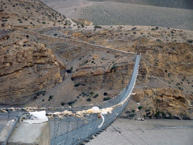
Had an okay sleep. Lo manthang, the capital city of Mustang lies 4 days ahead.
Day 4: Kagbeni via Tanbe and Chupsang to Chiele (3100 m)
We made a late morning start from Kagbeni, having a local favorite Tibetian bread as breakfast. We started off at ease and started our way through the wind ravaged trail along the Kali Gandaki river, leaving the Nilgiri and the Annapurna mountains to the south. As we climbed the Grand canyon type of trails, we started seeing the contrasting landscapes of arid mixed with meadows that extended all the way to the holy temples of Muktinath. On the journey we met a couple of hindu devotees returning from Damodar kund ( a holy lake 2.5 days east of Lo-manthang at 5200m). Looking at their meager belongings, we were amazed they could have made it back from such high altitude and cold place, fine)
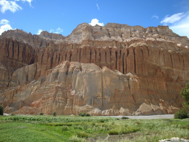
In 2 hours, we came across, Tangbe (3000m) a village that looked like a haunted village (because all its inhabitants were busy working in the nearby fields). We chanced upon an old man besides his apple orchard and quickly bought a kilo of Green apples freshly plucked from his orchid right there. As we walked to Chupsang, we could see some ancient caves on the other side of canyons. We meant to have lunch there but was thwarted by a massive road block where a massive dozer was building a road and had destroyed the trail along the Kali Gandaki river. A camping group helped us navigate this treacherous hair-raising cliff walk, across a make shift thin trail along a steep slope and last pull from more helpers before we could safely continue off to Chupsang. Chupsang looked like a disorganized village with the only motel (tea house) packed with travelers and locals gambling away infront of it. We had a quick instant noodles and made our way off to Chiele.
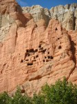
Here, we came across gorgeous mountain caves perched high up on the canyons as we walked besides the fast flowing Kali Gandaki river. It is hard to imagine people used to live here till a century ago. During summer, even the feeble Kali Gandaki rages dangerous. (During the winter it is possible to ride all the way to Lo-Manthang on a horse through the same river in 1.5 days).
We reached Chiele around 4 pm, a pretty cliff side village on top of the massively twisting and turning Kali Gandaki river. The last 100 meters to Chiele was a steep climb, and our inexperienced walk and terrible shape, nearly broke us down.
We stayed at Bishal Hotel, recommended by fellow Mustang guides who were traveling with a french group. I couldn’t sleep much tonight maybe because my body was adjusting itself to altitude. From 800 m to 3100 m in 2 days, yes this body needs a few adjusting to do.
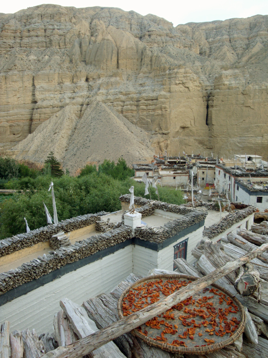
Day 4: Chiele to Syangboche (3800m) via Samar
We started off the morning late, and found our-self agonizingly short of breath walking through a steep exhausting mountain climb of 500 meters to Samar. My shoulders were pretty swollen from carrying my slightly overweight back-pack.
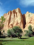
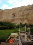
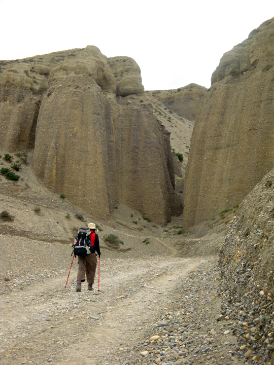
You will find yourself walking through cliffs that would hands down beat those cliffs in that last fight scene in the 1992 Daniel Day-Lewis film “ The last of the Mohicans”. Around mid-day, climbing up the canyon, we reached the village of Samar, a beautiful village, full of green poplar trees. It looked like a green oasis surrounded by deserted arid mountains. On the West were big cliffs separating Upper Dolpo valleys from Mustang. On the south you see the Tilicho and Nilgiri mountains near the Thorang la pass (which is part of the Annapurna Circuit trek. After having a quick-lunch at a beautiful cosy lodge there, we headed for Syangboche through the high route which took us to nearly 4000 m.
Note* I recommend the lower route from Samar to Syangboche, as it is easier to get to and easier to aclimitize, coming from Samar.
It proved to be an exhausting route up and down and after 4 hours we stumbled to Syangboche. It was cold up here, with only 3 houses, The second one happened to be our resting place for the night. The high point of the day had to be the steep cliffs and the scenic mountains you can see from high above Samar and the Soi la pass at 3900m from where we can see rugged dry hills of Upper mustang).
We stayed at Dhaulagiri Hotel which was a good choice. Had an excellent sleep.
Day 5: Syangboche to Dhakmar (3750m) via Ghemi.
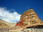
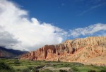
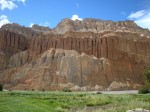
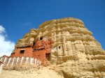
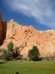
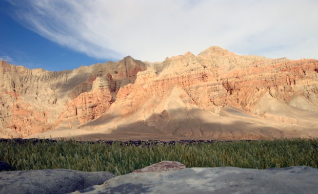
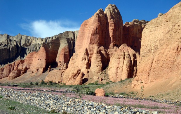 We passed through stunning display of nature passing through scenic villages of Gheling, Bhene and through the Nyi La pass (4000m), we arrived at Ghemi, another lovely green village amidst a red, and ash colored wind beaten cliffs with more caves. After having a delicious lunch at a home of the Raju Bista, a nephew of the former King of Mustang, we headed to the picture perfect Dhakmar famed for its red cliffs. Legend has it that these cliffs were a result of the blood smeared out of the body of the demon Queen who was slayed nearby by the Buddhist monk, Guru Padma Sambhawa. He slayed her to protect the Samya region in Tibet who were unable to build the Samya Gompa monastery because demons and their queen would destroy any monastries they built.
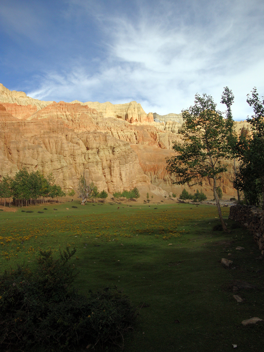
The legend further elaborates the long wall in Ghemi is where her intestine were buried and the nearby Lo Ghyakar (Ghar) Gompa, an 8th century monastry was built over her dead body which protects against her resurrection. An hour away from Ghemi, we arrived at the picturesque Dhakmar, which seemed to hold up to its reputation. In Dhakmar we shared our room with another group since the lodge Tenzing riverside had barely 2 rooms available. We specially loved these fresh organic vegetables that we always ate for dinner wherever we stayed in Upper mustang, specially the spinach, potatoes and cauli flowers.
Day 6: Dhakmar to Lo- Manthang (3800m)
We started climbing up a cliff up the 4200m pass separating Dhakmar from Lo-manthang. At this altitude, it becomes excruciatingly hard to find enough air to climb a few steps. After a 2 hour climb, we reached the 8th century monastery called Lori Ghyakar (ghar) Gompa. Rich in Tibetan folklore, we were told about the history of the monastry by a lone monk staying there. We were hoping to having lunch in this area but couldn’t find any place to eat, so we headed off to Lo-manthang eating our packed food supplies. Highly recommend carrying packed supplies if you are traveling this route.
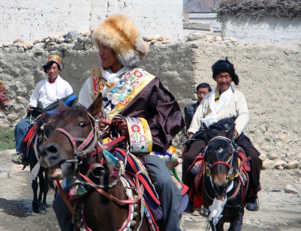
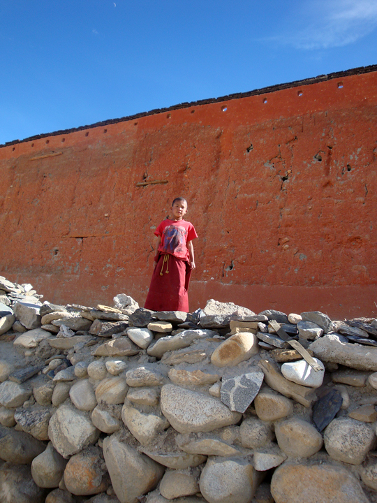
The walk forward was picturesque with wild horses and sheeps grazing in multitudes along endless meadows that seemed to disappear into the high mountains. And we could see the 4600m Kora-la pass in the distance, which separated Nepal from Tibet. We finally reached the red fortress city of Lo-Manthang around 4pm. Lo-Manthang looked beautiful with contrasting colors at this time of the year. The pink barley fields surrounding the red fortress seemed to heighten the festive atmosphere, with people with distinctly colorful costumes and the blue sky.
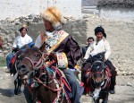
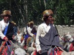
<img title=”Mustang is also known for its wild horses, here near Lo-manthang, capital of Upper Mustang ” src=”https://fbcdn-sphotos-d-a.akamaihd.net/hphotos-ak-prn1/46487_469304262773_3190843_n.jpg” alt=”Mustang is also known for its wild horses, her</a/>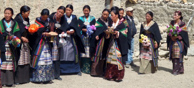
In the afternoon, we hired a few horses. It was my first horse ride and add to that , my first fall from the horse as well. Luckily nothing serious but the fall served to give amusing laughs for my fellow travelers for the rest of the journey! We traveled to the nearby villages of ….. and Chungsar where we visited the fabled caves and cave monastries along steep cliffs. We were left wondering, about how people lived in these caves centuries ago. The weather was perfect for a lazy stroll inside Lo-manthang. People were jolly with harvesting season just around the corner. At a local tea-shop, old women were dancing drunk and so it was fascinating to see old women dance to the latest bollywood re-mix !
Lo-Manthang is a town full of buddhist monasteries. Every direction there are gompas (monasteries). The King’s palace lies smack in the middle of the town. You can get an appointment to meet him, if you like. Its a place thats a mix of a millenia old customs and habits mixed with 21st century.
Day 9: Lo-Manthang to Tse-rang, pronounced Chha-rang(3500m).
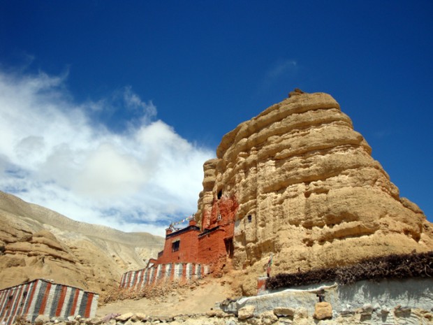
Today we strolled down the lone dusty wide road to Tsarang (about 4 hours). Not very eventful other than the stark arid landscape that were on both sides of the road. But as reached Tsarang, we came across another lovely colorful village with its own palace and monasteries. At Tsarang, the weather started getting heavy, and it started raining. The mist covered the entire valley and made the visual very surreal. We visited the ruins of the palace there and the big monastery near it. We stayed at a local hotel, Mount Kailash, just on the edge of the town and had a comfortable stay.
Day 10: Tse-rang to Syangboche (3800m)
It was a tough 7and a half hour walk back to Syangboche, partly because we decided to go through a village of Gheling, a bit off route on the way. We again passed through the lovely village of Ghemi, where we dropped by the same tea-house for lunch. By the time we reached Gheling, we were exhausted, and the last part of the journey to Syangboche became tasking. We happened to meet the people who were making the roads there. I reckon, in a couple of years, Lo-manthang will be a major stop on the way from Pokhara to the holy places in Tibet, Mount Kailash and Lake Manasarovar. I can only wonder what changes will happen, inevitable it is. I am sure, more eyes will get to see the wonders we have viewed so far. I sense, Mustang is readying itself for such a profound change.
Day 11: Syanboche to Chupsang (3000m)
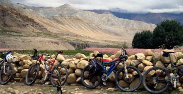 From Syangboche we took a foggy route that took us down to the natural holy caves of Chung Gompa and along deep canyons. Chung Gomba is a cave where the stones are said to have formed the shape of buddhist deities. It is in an exotic location right in a mountain off a gorge. From there we made a steep climb up to Samar where we had excellent lunch waiting for us.
From Samar it was an easy walk down another deep gorge, and finally we reached on the banks of a small river by Chupsang. But the river level suddenly had started rising and we had to cross the river with water up to our thighs, amidst a high current. I was not amused to see the locals sitting and enjoying the sight of us trying desperately to cross. At Chupsang we stayed at the only motel, the Bhrikuti hotel. It was quite expensive being the only one in this village. One a sidenote: I noticed, there was more trash lying in one street of Kathmandu than what I have seen in the entire Mustang.
Day 12: Chupsang to Kagbeni (2900 m)
In the morning, the locals mentioned we couldn’t cross an easy 10 minutes section of the trail because the dozers had bull dozed the trail off while building the road. What they forgot to tell us, was that it would take us one and half hours to cross that, by going steep up the cliff, and coming down just across the road block. After the agonizing climb up and down, we were off to Tangbe, where we chanced upon the same apple seller by his orchid. This time we bought apples from him at 33% inflation from his earlier rate 5 days ago. After two more hours we were back in Kagbeni where we decided to stay for the day. (Our original plan was to get to Mukti-nath which was another 3 to 4 hours of steep walk).
At Kagbeni we decided to stay with our new-found french friends at Hotel Nilgiri. As we arrived around 2, we had plenty of opportunity to check out the town with its mixture of Hindu and Buddhist culture and heritage.
Day 13: Kagbeni to Muktinath (Rani Pauwa) 3800 m
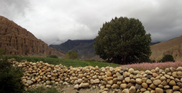
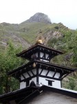
From Kagbeni we decided to go off to visit Mukti-nath temple off the route to Jomsom. Muktinath lies on the way to Thorang la pass which separates Manang from Mustang (and is part of the Annapurna Circuit trek). Muktinath is an extremely popular pilgramage site with hindu devotees and is perched on the side of high mountains with Buddhist nuns taking care of the Hindu temple. It is known for emiting a never-ending gas geyser and for the stunning views of Upper mustang to the north and the Annapurna and Dhaulagiri to the south-west. We had a delicious lunch at North Pole hotel and headed back to Jomsom using the preferred way through a 4 wheel Jeep, which only took us one and half hour along this windy, dusty route.
Day 14, 15: Jomsom to Tatopani
Our flights got canceled for 2 consecutive days in Jomsom. So we had no choice but to take the land route. We must have changed vehicles for 11 times before we reached Pokhara. Traveling through land linking Mustang to the rest of the country is very dangerous during monsoons because of heavily damaged paths, landslides and atrociously dangerous roads. I wouldn’t recommend the land route but because there is hardly any other option, most travelers have to take it, when flights get canceled. We stayed in the motels nearby the hot springs called “Tatopani” where we rejuvenated our tired bodies.
Day 16: Tatopani to Pokhara.
From Tatopani we again took the dangerous route off to Pokhara. It was a hell of a ride and took all day because of the almost totally destroyed mud roads, our 4 wheelers had to pull through, with the raging Kali Gandaki river ever watchful. Finally at around 9 in the evening we reached Pokhara and back to civilization where finally to a bed more closer to what we had at our homes !
I hope you enjoyed the diary as much as we enjoyed our trip 🙂 Feel free to share your questions or thoughts below! You can check out more photos at this link below.
If you need more Nepal travel tips and help go to this website





















Enjoy traveling !
dai great one.. helping me lot to plan my upcoming visit…. Keep it up daiii
i got one word for you, uj: JEALOUS.
nice pictures! on my to go list.
hope you go there soon before the roads are built.